Mexican Way Stations Mark Trail of Illegal Immigraion to US
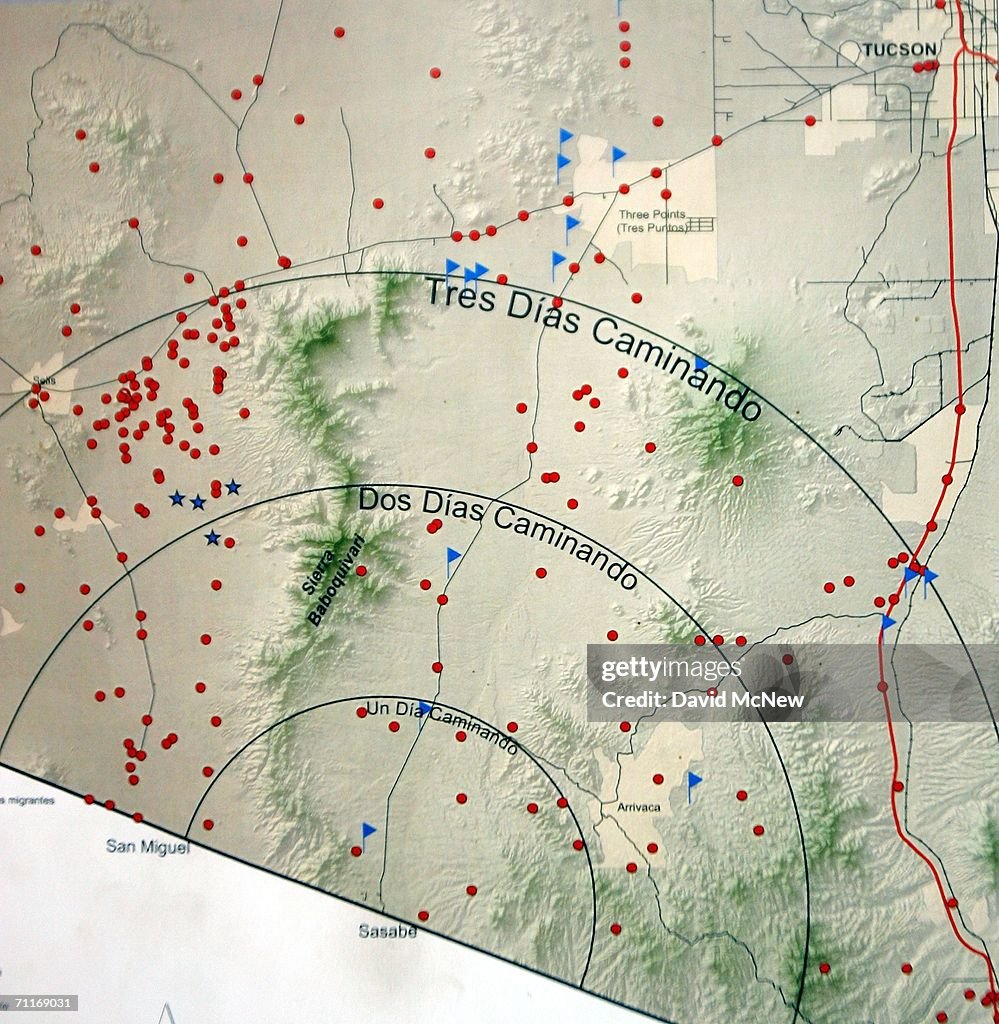
ALTAR, MEXICO - JUNE 06: A map on the wall in the Mexican Red Cross mobile clinic shows how far immigrants can walk from the border at Sasabe with circles indicating one- ,two-, and three-day distances on June 6, 2006 in Altar Mexico, 60 miles south of the border village of Sasabe. Most immigrants walk for three days or more. The red dots indicate known sites of immigrant deaths, blue flags indicate water, and blue stars show where rescue beacons can be found. More illegal immigrants pass through Altar where immigrant smuggling is the primary industry, than any other town. Available services include "coyotes" or guides, transportation over 60 miles or more of dirt road in vans carrying as many as 25 people, about 150 "hospedajes" or guest houses, provisions, a free mobile clinic catering mostly to people who were hurt trying to cross the border, and groups who warn immigrants on the dangers of the trek and help those in need. From here, most immigrants are guided through Sasabe, where nightly robberies have become an industry and rape is common, then across the US-Mexico border to walk for about 45 miles through the desert before being picked up by smuggler vehicles. It is during the walk that most of the 473 deaths of 2005 occurred, mostly from exposure to extreme heat and fatigue. (Photo by David McNew/Getty Images)

EINE LIZENZ KAUFEN
Wie darf ich dieses Bild verwenden?
475,00 €
EUR
DETAILS
Einschränkungen:
Bei kommerzieller Verwendung sowie für verkaufsfördernde Zwecke kontaktieren Sie bitte Ihr lokales Büro. Vollständige redaktionelle Rechte in Großbritannien, USA, Irland, Kanada (außer Quebec). Eingeschränkte redaktionelle Rechte für Tageszeitungskunden in allen anderen Ländern. Bitte kontaktieren Sie uns.
Bildnachweis:
Redaktionell #:
71169031
Kollektion:
Getty Images News
Erstellt am:
6. Juni 2006
Hochgeladen am:
Lizenztyp:
Releaseangaben:
Kein Release verfügbar. Weitere Informationen
Quelle:
Getty Images North America
Objektname:
71111165DM042_Mexican_Way_S
- Auswanderung und Einwanderung,
- Dorf,
- Einwanderer,
- Entfernt,
- Gestikulieren,
- Justizwesen,
- Karte - Navigationsinstrument,
- Kontrolle,
- Kreis,
- Lateinamerika,
- Lateinamerikanische Abstammung,
- Mexiko,
- Politik,
- Praxis,
- Rettung,
- Rotes Kreuz - Organisierte Gruppe,
- Spionage und Aufklärung,
- Staatsgrenze,
- Unfall und Katastrophe,
- Verbrechen,
- Zeigen,